
The full picture, free forever.
Not a simplified hobby map. The same airspace a manned pilot would brief, filtered down to what matters below 400 ft. No account needed to look.
The official UK dataset, refreshed every AIRAC cycle.
Boundaries with the vertical limits that apply to each one.
Civil and military, from the surface upwards.
Where mandatory equipment applies.
Drawn dashed like a real chart, with activation hours.
What is actually in the air over the site, coloured by height. The helicopter at 800 ft is in no NOTAM.
Chimneys, water towers and turbines too, with conductor spans drawn as a corridor. Not yet dependable, and it says so when it has nothing.
There when you need them, one tick away.
Airspace is not the only thing up there.
Every UK drone map draws the same restriction zones from the same official dataset. Two layers here do not come from it, because the hazards they cover are not published as airspace at all. One is solid; the other is honest about not being, yet.
Aircraft broadcasting on ADS-B, drawn as arrows pointing along their track and coloured by height: red below 1,000 ft, amber to 5,000, blue above. Click one for its callsign, type, height and rate of climb. It updates every ten seconds while the layer is on.
It shows what is broadcasting and being heard, which is not everything flying. A light aircraft without a transponder, and often military traffic, will not be there. Treat it as a second pair of eyes, never as a clearance.
Masts, communications towers, chimneys, water towers, wind turbines and pylons, with transmission lines drawn as the corridor to stay clear of rather than a hairline you can miss. One county view holds hundreds of them.
Beta, and honestly so: the public OpenStreetMap query service refuses our requests often enough that this layer regularly has nothing to show. When that happens it tells you, rather than letting an empty map read as clear ground. It is also contributed data rather than a survey - a structure can be missing and most do not publish a height.
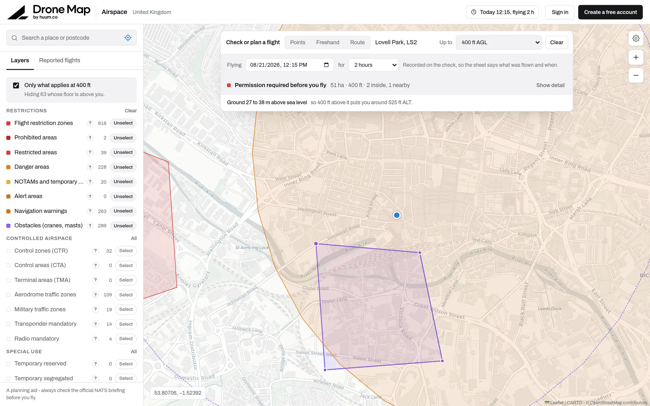
Hover a zone for its name and vertical limits. Click for the full record: reference, limits, activation hours and source.
What actually affects you below 400 ft is on by default. Everything else is one tick away.
Six base maps, a 3D view with real terrain and buildings, place and postcode search, and use-my-location.
Airspace changes. You will know.
Watch a site and it is re-checked against the latest airspace every time you open the map. A new restriction over somewhere you fly regularly raises an alert on your dashboard.