
This is the whole thing.
Every client, every site, every job, and the money attached to each. The airspace check is one row on a job, not the reason the software exists.
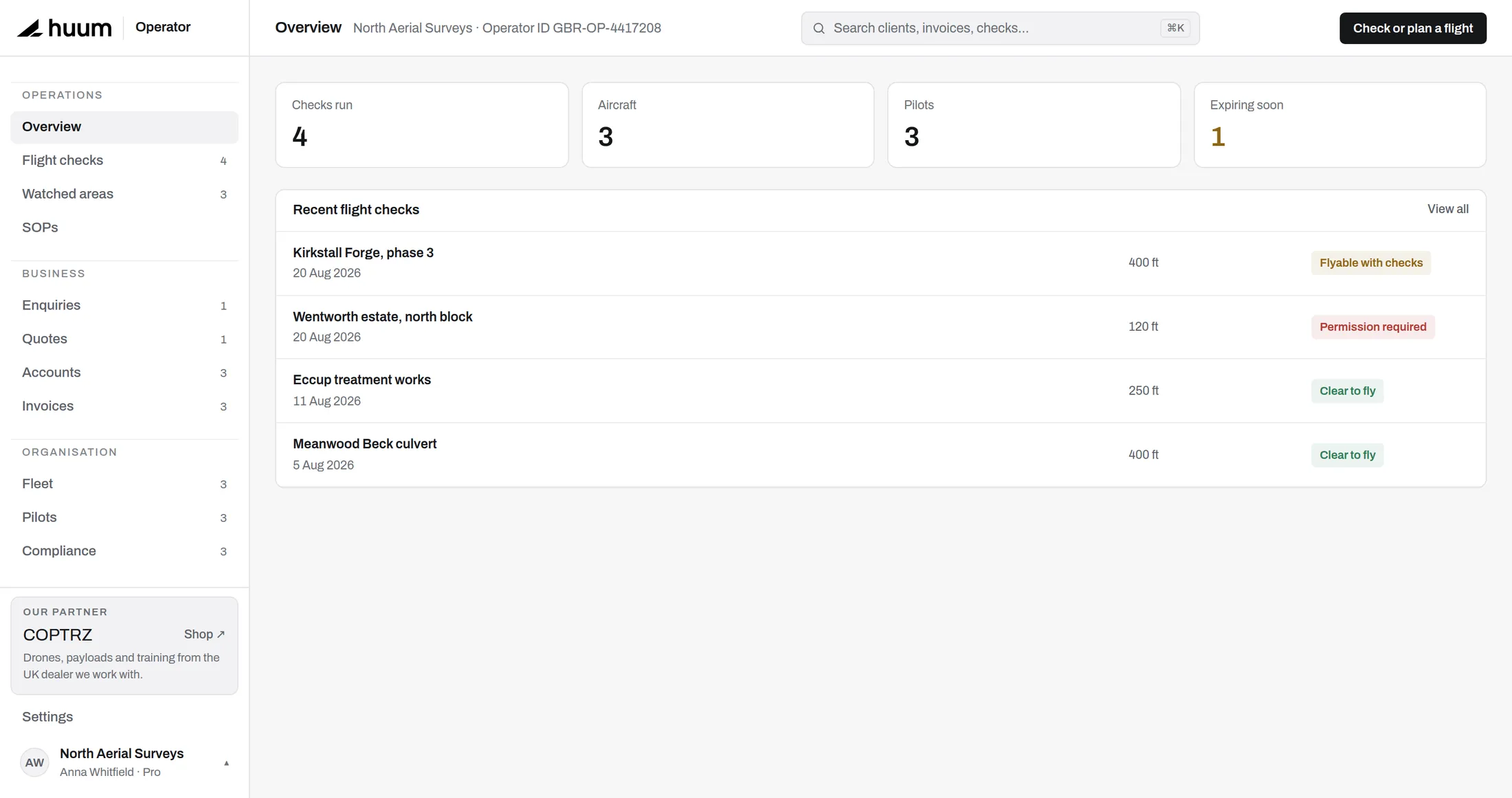
From enquiry to settled invoice.
The parts most operators run on a spreadsheet and a notes app, in one place that knows they are related.
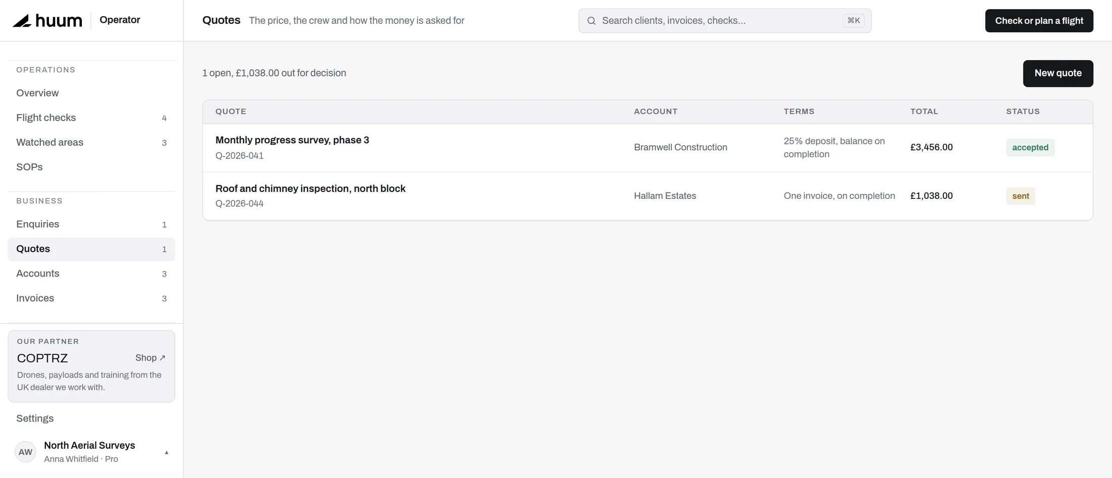
Price the work by line, send it under your own name, and when it is accepted the job already exists - client, site, scope and value carried over.
A site remembers what you flew there last time, what the access arrangement was, and which check you ran. The second visit is not a fresh start.
Who is flying, which aircraft, and whether their tickets are still in date - answered before the van leaves.
Your logo, your terms, your payment details. Nothing on the document says huum.
Connect your own Stripe account and client card payments land with you directly. We never hold your money.
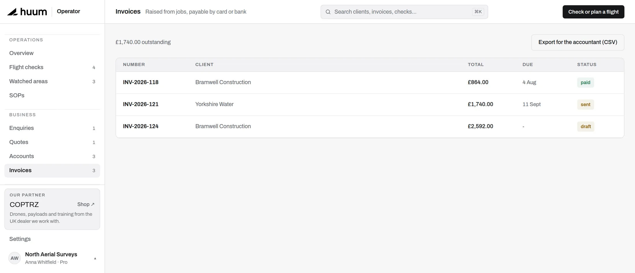
Outstanding, overdue and paid, per client. The number you actually want on a Monday morning.
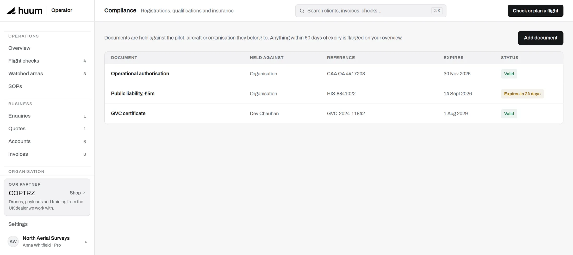
The paperwork, kept current.
Records an insurer or a client's procurement team can be shown without a week's notice.
Every airframe with its operator ID, class marking and service history.
Qualifications and currency, per person, with the certificate attached.
Insurance, permissions and certificates, flagged before they lapse rather than after.
Hours that add up on their own, from the jobs you already recorded.
A standard operating procedure drafted from your real fleet and pilots, for your accountable manager to adopt.
Specific category work, delivered with COPTRZ. You bring the records, they bring the case.
The airspace map, on its own terms.
Free to anyone, account or not. Signed in, every check you run attaches itself to the job it was for and stays there as a dated record.
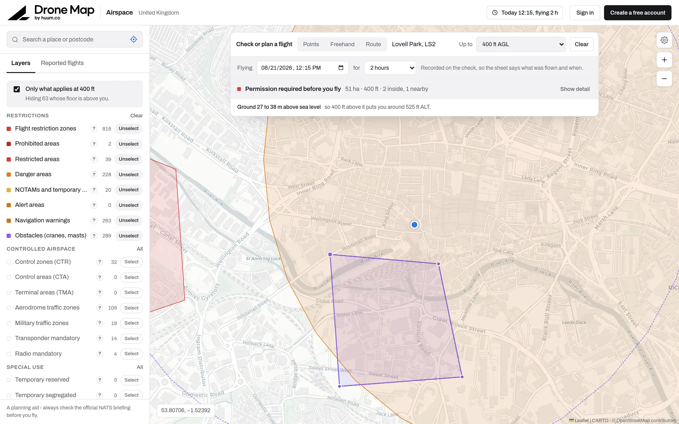
Flight restriction zones around airports, danger areas and restricted airspace, from NATS aeronautical data on the 28-day AIRAC cycle.
Sites of Special Scientific Interest across England, Scotland and Wales, and Areas of Special Scientific Interest in Northern Ireland.
Special Protection Areas and Ramsar wetlands, which often extend over estuaries and open water beyond the SSSI boundary.
National Trust and National Trust for Scotland property, where byelaws prohibit launching or landing without permission.
What is actually in the air over the site right now, from the ADS-B receiver network, coloured by height.
Pylons, chimneys and turbines from OpenStreetMap, with conductor spans drawn as a corridor. Still unreliable: the public data service often refuses us, and the layer says so when it does.
Wind, gusts, cloud and rain for wherever you are checking, not for the nearest city.
Four things no other free UK drone map does.
Every UK drone map draws the same restriction zones from the same official dataset. These are the parts that are ours.
The map is free. The record keeping is not.
Pro covers a single pilot. Team is the same thing for an operation with more than one. There is no trial period: the map and your checks are free for as long as you want them.
The honest answers.
No. It shows you the airspace and tells you what applies. Permission still comes from the airspace owner, and the decision to fly is yours.
Restriction zones and controlled airspace follow the AIRAC cycle. NOTAMs and temporary restrictions come in live.
No. It produces a standard operating procedure template for your accountable manager to review and adopt. A UK SORA application, which replaced the Operating Safety Case in April 2025 as the way to apply for an operational authorisation, is a different document with a different bar.
The last airspace picture you loaded stays readable. Check before you leave, and it is still there when you arrive.
Only your organisation. Isolation is enforced in the database with row-level security, not just in the app.
Yes. Start on Pro and move to Team when you add a second pilot. The map and your checks stay free either way.

Check your next site in
under a minute.
The map and unlimited checks are free. Keeping the record starts on Pro.